I need to create a detailed wire frame map over the top of a Google Earth Image. The map is a fiber / data - map that shows paths both logical and physical. I'm not sure where / how to use these features and need assistance.
The mapping is critical for "distance" so a proper scale guide and relation is required.
Objects from architecture data networking office space floor plans - all must be used as well.
Please advise on how / where to begin. I have ZERO experience in any of this type of program.
Thank you.
Best answer by Micah
Hi Gerald
Thanks for posting in the community - it sounds like you have a really interesting use case! To begin I recommend taking a look at our Getting Started with Lucidchart guide. This will familiarize you with Lucidchart's basic tools and functionality and help you get comfortable before using more advanced shapes and functions.
For your specific diagramming needs Lucidchart has several shape libraries and templates that I believe will suit your needs:
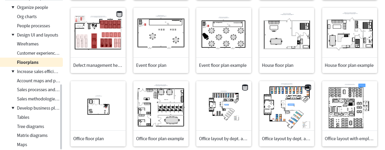
Templates: By selecting "New Document" and then "From Template" you will have access to Lucidchart's template gallery. Simply search for what you are looking for using the search bar in the upper left-hand corner. There are many templates that correspond to your description - wireframes floor plans and networking. I've included a screenshot of some of our floorplan templates below. Note that our floorplans also contain a measurement tool and will allow you to scale your diagram to suit your needs.
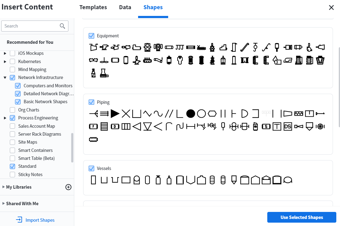
Shape Libraries: From within a document select the "Shapes" button in the top of the left panel. This opens the shapes manager in which you can search for specific shape libraries. I recommend taking a look at the following: Circuit Diagrams Cisco Network Icons Floor Plans Network Infrastructure Process Engineering and UI Mockups. I've included a screenshot of some of our Process Engineering shapes below as an example.
I suggest spending some time looking at our various templates and shape libraries that you can combine to suit your needs. As additional resources feel free to take a look at the following Help Center articles for more in depth instructions:Add and customize shapes; Create floor plans to scale. Hope this helps! Please let me know if you have additional specific questions.
Thanks for posting in the community - it sounds like you have a really interesting use case! To begin I recommend taking a look at our Getting Started with Lucidchart guide. This will familiarize you with Lucidchart's basic tools and functionality and help you get comfortable before using more advanced shapes and functions.
For your specific diagramming needs Lucidchart has several shape libraries and templates that I believe will suit your needs:
Templates: By selecting "New Document" and then "From Template" you will have access to Lucidchart's template gallery. Simply search for what you are looking for using the search bar in the upper left-hand corner. There are many templates that correspond to your description - wireframes floor plans and networking. I've included a screenshot of some of our floorplan templates below. Note that our floorplans also contain a measurement tool and will allow you to scale your diagram to suit your needs.
Shape Libraries: From within a document select the "Shapes" button in the top of the left panel. This opens the shapes manager in which you can search for specific shape libraries. I recommend taking a look at the following: Circuit Diagrams Cisco Network Icons Floor Plans Network Infrastructure Process Engineering and UI Mockups. I've included a screenshot of some of our Process Engineering shapes below as an example.
I suggest spending some time looking at our various templates and shape libraries that you can combine to suit your needs. As additional resources feel free to take a look at the following Help Center articles for more in depth instructions:Add and customize shapes; Create floor plans to scale. Hope this helps! Please let me know if you have additional specific questions.
None of these items cover what I need to do. I need to be able to draw (outline buildings) and create paths over the top of a Google Earth image. I also need the drawing to be set at a specific scale that will not change when enlarging or reducing the drawing.
None of the Templates will be useful as all of our work is "free drawn". Some of the symbols will be useful but shapes will not. I'll follow the information provided on the training and go thorough those sections. Hopefully I can make some sense of how to navigate through this product.
I'm presuming that since this is a "WebApp" there is not an "Off-Line" version available as well?
Thanks for continuing to clarify your goals! I made suggestions based on your initial description but I would be happy to continue to point you in the direction of different functionality if you can provide me with more details about your use case. To address two of your points-while you can certainly place shapes and diagram elements on top of an image Lucidchart does not support free-hand drawing. If this is something that would be useful for you please add your thoughts to our feature request form - ideas submitted here are passed along directly to our development team. Additionally Lucidchart does support offline mode! To learn more about its set-up and functionality please refer to our Offline Mode article and let me know if you have any additional questions.
For our use case we take a Google Earth photo outline each building (very irregular shapes) - and then draw the "Physical" path line of our fiber/copper that is buried in the ground to the corresponding buildings. We use a measurement tool to validate the length of each run from Point A to Point B. We also draw lines around the property lines so that we have a visual reference of our facility. Additionally around the perimeter we may have fiber runs that we have to track from Point A to B to C and so forth - as well as keeping the proper distance measurement for every run.
I can provide a sample if that would help to explain as well.
Regarding the Off-Line option I will look at the article you provided.
A Lucid or airfocus account is required to interact with the Community, and your participation is subject to the
Supplemental Lucid Community Terms.
You may not participate in the Community if you are under 18. You will be redirected to the Lucid or airfocus app to log in.
A Lucid or airfocus account is required to interact with the Community, and your participation is subject to the
Supplemental Lucid Community Terms.
You may not participate in the Community if you are under 18. You will be redirected to the Lucid or airfocus app to log in.